Join World's Fastest Growing B2B Network
Join World's Fastest Growing B2B Network


| Port | Dehradun |
| Packaging | Cardboard Box |
| Lead Time | 3-4 weeks |
Description
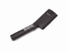
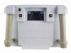
Magnetometer provides a reliable, low cost solution for a variety of magnetic search and mapping applications. It can be operated by non-technical field personnel or used in teaching environments. Proton magnetometer uses the well-established proton precession method, allowing accurate measurements to be made with virtually no dependence upon variables such as sensor orientation, temperature, or location. The unit provides a repeatable absolute total field magnetic reading, traceable to the National Institute of Standards and Technology. The unit offers new features such as GPS time synchronization, GPS positions and in-field navigation.
Applications
Proton magnetometer is ideal for mapping geological structures, for mineral exploration, or magnetic search for industrial, environmental or archaeological targets. Simple operation, large digital data storage capability, and the inclusion of data transfer and editing software provides a system well suited for both teaching and survey applications.
Superior Data Editing Software
It allows rapid download of the data from the Proton magnetometer to a PC. Data can be diurnally corrected, profile lines and X, Y or GPS positions displayed and edited, noisy readings filtered and QC plots of profiles, 2D contour plots made. Data can be exported for more sophisticated final maps and analysis including Google Earth overlay maps. The software requires Windows XP, 7, 8 or 8.1 operating system.
Proton magnetometer provides excellent performance and is the lowest priced professional magnetometer system available. With simple operation, user friendly download/editing software, and format read for available commercial contouring programs, it represents a complete magnetic surveying package generating high quality data for budget conscious users.
Features
Multi-tone audible target indication.
Graphic LCD display.Data Storage to SD Memory Card.CSV Data
format for easy data import to Analysis Software.ATmega1281
Microprocessor.Data Visualization software for Windows
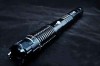
PC.Integrated GPS.Noise Canceling Sensor with 6'''' (2m)
cable.Internal Rechargeable Battery.
Specifications
Relative sensitivity: 0.1 nT @ 1 HzResolution: 0.1 nTAbsolute
Accuracy: +/- 1.0 nTRange: 40,000 to 60,000 nT (Other tuning
ranges available 20,000 to 80,000 nT,)Period of measurement: 1
- 3 seconds.Operating temperature: 14F to 120F (-10C to
+50C)Memory capacity: up to 2 gigabytes (SD Memory
Card)Battery: 12V 7Ah SLABattery life: ~8 hours.
GPS
Trimble Condor GPS chipsetSupport for SBAS using WAAS or
EGNOSupdate Rate 1 HzAccuracy: Position < 5m Position 2 m
(WAAS)Cold Start < 38sSensitivity: Tracking -160dBm
Acquisition -146dBm
One moment please
 Member's Area
 Messages
  Need Help