Join World's Fastest Growing B2B Network
Join World's Fastest Growing B2B Network


| MOQ | 1 unit |
| Port | Air freight |
| Packaging | Air freight Cargo |
Description:
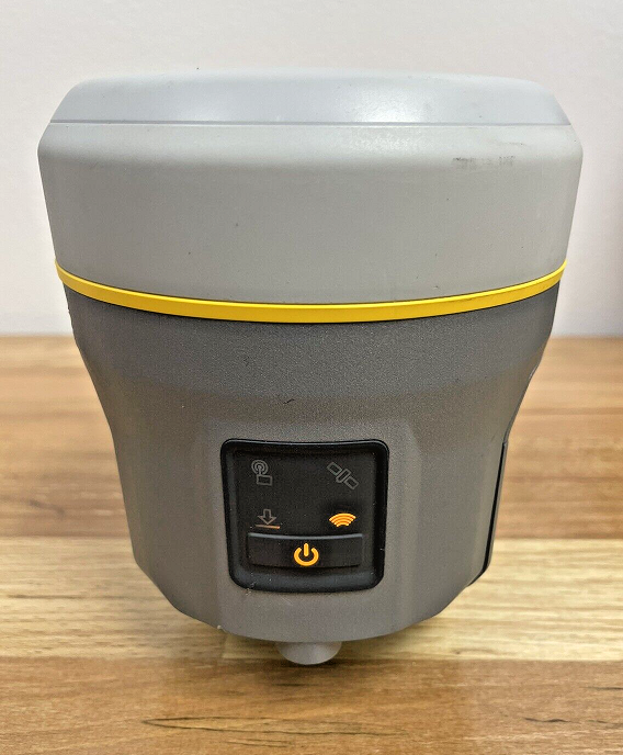
The Trimble R10 Network Receiver is an advanced GPS GNSS land
surveying instrument, engineered to deliver superior performance
and precision. Designed with cutting-edge technology, the R10
Network Receiver is a reliable tool that enhances data collection
efficiency and accuracy for land surveyors and geospatial
professionals.
Feature Detail:
GPS GNSS Technology: The Trimble R10 is equipped with GPS and
GNSS (Global Navigation Satellite System) capabilities, providing
accurate positioning data from multiple satellite
constellations.
Multi-Constellation Tracking: The R10 can track signals from
various satellite constellations, such as GPS, GLONASS, Galileo,
BeiDou, and QZSS, maximizing satellite availability and signal
reception.
High-Precision Measurements: With advanced GNSS technology, the
R10 delivers precise position, elevation, and timing data,
ensuring reliable surveying results.
Real-Time Kinematic (RTK): The R10 supports RTK positioning,
enabling real-time, centimeter-level accuracy, ideal for
high-precision surveying tasks.
Trimble xFill Technology: xFill maintains RTK positions even when
radio or cellular communication is temporarily lost, ensuring
continuous data collection in challenging environments.
SurePoint™ Tilt Compensation: The R10 is equipped with SurePoint™
technology, compensating for pole tilt and providing accurate
measurements, even on uneven terrain.
Long-Range Radio Communication: The integrated radio module
allows for long-range communication between the R10 rover and
base, facilitating extended surveying coverage.
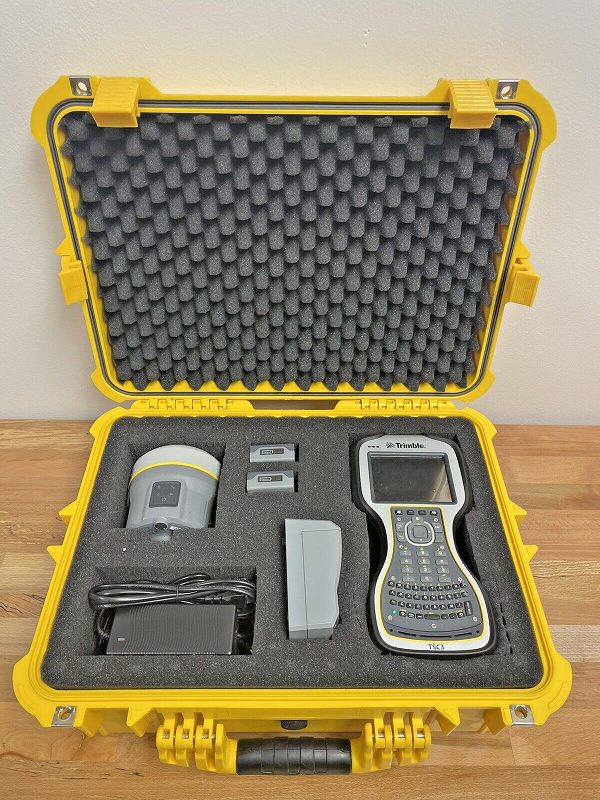
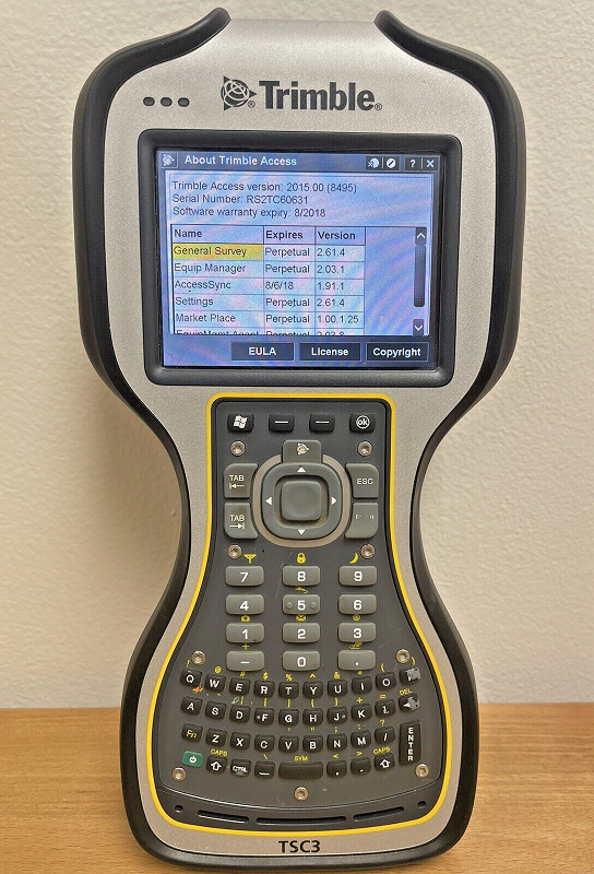
Trimble Access Software: The R10 is compatible with Trimble
Access software, offering a user-friendly interface for survey
planning, data collection, and post-processing.
Long-Lasting Battery: The R10 features a high-capacity,
rechargeable battery, providing extended fieldwork time without
frequent recharging.
Rugged Design: The R10 is built to withstand harsh environments,
with an IP67 rating for dustproof and water-resistant
performance.
Specification Detail:
Number of GNSS Channels: Typically more than 600 channels,
ensuring robust satellite tracking.
RTK Accuracy: Typically sub-centimeter accuracy in RTK mode.
Static Surveying Accuracy: Typically millimeter-level accuracy
for long-duration static surveying.
Communication: Integrated radio module for long-range
communication between rover and base.
Battery Life: Long-lasting battery for extended fieldwork.
Memory: Internal memory for data storage.
Display: High-resolution LCD display for easy data visualization.
The Point Instrument, Mononutu No 273 Block F Stadion Ternate, 97711 Maluku Utara Indonesia
One moment please
 Member's Area
 Messages
  Need Help